|
|
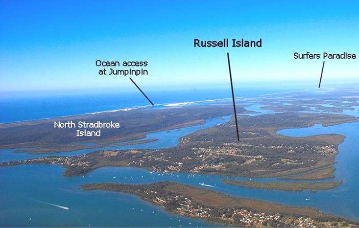
RUSSELL ISLAND
|
|
Subtropical Island,
halfway between Brisbane and the Gold Coast
|
|
|
|
|
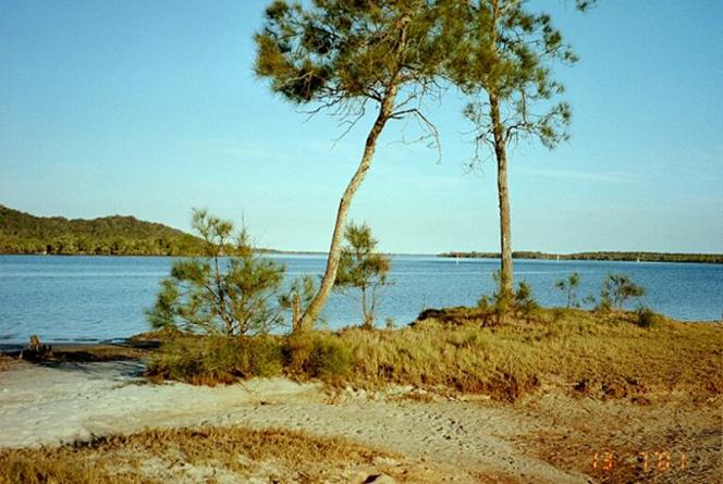
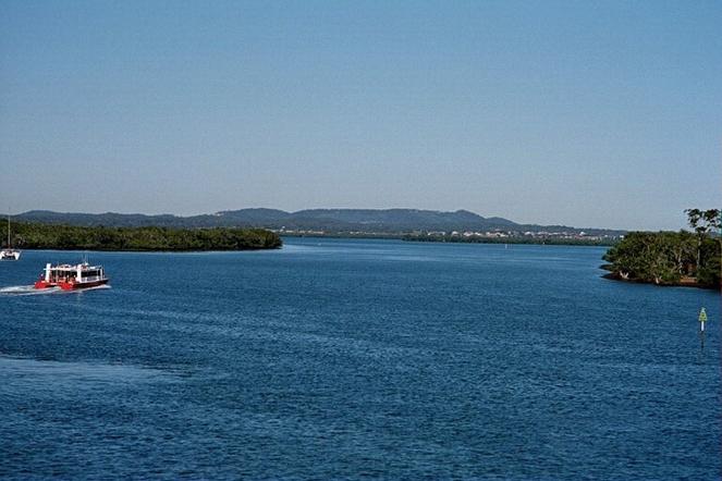
From the northern tip
of Russell Island looking south towards the top of the
Gold Coast in the far distance
|
|
|
|
|
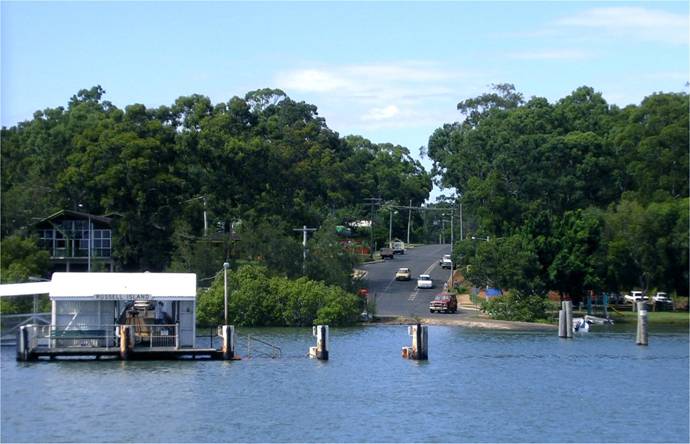
View looking south down
High Street from the water-taxi at high tide. The water-taxi docks
at the jetty on the left. There is a boat ramp to the
right.
|
|
|
Russell Island - Aboriginal
name: Canaipa meaning 'ironbark spear'
|
|
|
Russell Island is the largest in a group of
islands in the southern waters of Moreton Bay between
North Stadbroke Island in the east and Redland Bay in
the west. The Gold Coast Shire is a kilometre to the
south of the island. The main body of Russell Island
is seven kilometres long and ranges from approximately
1.25 to 3.25 kilometres in width, making it approximately
16 square kilometres in area.
The southern tip of Russell Island is 33 kilometres
in a straight line from Surfers Paradise, and it is
approximately one hour by road and waterbus. The northern
tip of the island is 40 kilometres in a straight line
from the centre of Brisbanes CBD, and approximately
one hour travel. For those with a boat there is fast
access to the mainland, Brisbane, Gold Coast, Sunshine
Coast, other islands in Moreton Bay and to the open
ocean.
Much of the urban areas on the island are attractive
having large gums and an abundance of wildlife co-habitating
with the sparse human population.
|
|
|
|
|
View from the south-east
of Russell Island looking toward Slipping sands on North
Stradbroke Island.
|
|
|
|
Island Time:
Turn your clocks back
20 Years.
A more relaxed pace
of life.
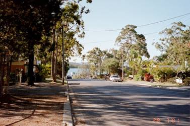
This is High Street
looking north to the main boat ramp. There is
a nursery and video rental, on the left and
library bottle shop, lawyer, doctor, chemist
and cafe on the right.
|
|
|
|
|
|
Late afternoon at Sandy
Beach typical of the southern end of the Island peaceful
with few visitors. North Stradbroke Island is on the
left. The Gold Coast Shire starts at the island on the
right and Jumpinpin is 8 km away.
|
|
|
|
|
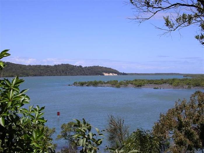
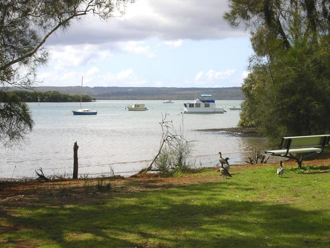
This is a small seaside
park on Krummel Passage at the north end of the island,
just west of the main jetty. North Stradbroke Island
is in the distance and Karragarra Island on the left.
|
|
|
|
|
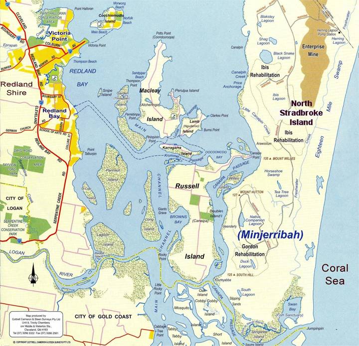
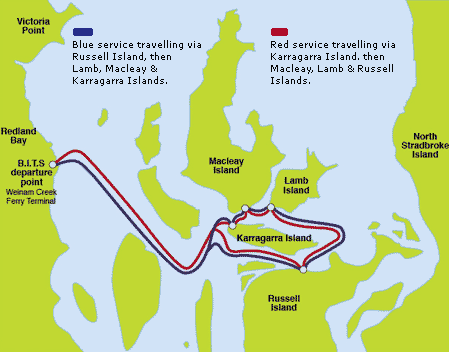
Southern Moreton Bay:
Blue
dotted lines depict the route the ferries take to the
islands
|
|
|
Russell
Island - Brief Description & Climate
Russell Island has a country town atmosphere
where the traffic is minimal, the air is fresh and the
gardens and bushland are a subtropical green. Being
an island, summers are cooler and winter temperatures
are milder. A sea breeze can be experienced all over
the island. The subtropical climate is ideal for outdoor
activities all year round. The average winter temperature
ranges from 11-21 degrees and summer is 18-28 degrees
Celsius. Most tropical fruits can be grown, which is
not always the case in areas on the mainland because
of frosts.
There are patches of rural land still remaining
on the islands, which in the past had been completely
cleared for various farming purposes including market
gardens, cattle grazing, avocado, mango, custard apple,
lychee, and pecan nut orchards. The soil type ranges
from very sandy to heavy red clay.
Russell
Island does not have any ocean beaches, with most of
the coastline bordered in mangroves. This provides a
natural and important habitat for the abundant fish
life including mud crabs, sand crabs, and prawns. The
protected waters in amongst and around the Southern
Moreton Bay Islands are ideal for boating, fishing,
catching crabs and prawns.
Russell Island is rich
in spectacular scenery and birdlife. One of the many
attractions on Russell is Turtle Swamp, which in spring
bursts into an array of wildflowers. Outdoor pursuits
such as bushwalking and cycling are both popular pastimes
on the island.
The Redland Shire Council, having a strong focus on
conservation, restricts tree removal until building
plans approved.
|
|
|
Gold Coast to the South
Russell
Island has relaxed living, close to the Gold Coast and
Brisbane, but without the pollution, noise, crime rate
and traffic congestion caused by unfettered development
and an endless stream of tourists.
|
|
|
|
|
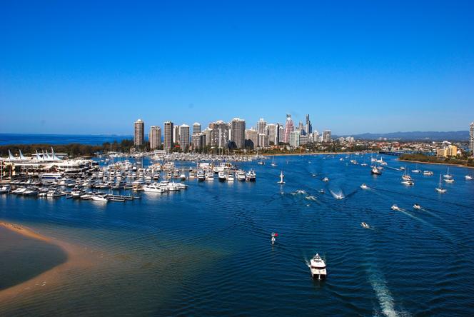
A view from north of
Main Beach, adjacent to the Spit, with Southport on
the right, showing the Southport Yacht Club to the left
and the high rises of Main Beach, Surfers Paradise,
and Broadbeach in the distance.
|
|
|
|
|
Photo taken from the
Barge looking back at mainland at Redland Bay.
|
|
|
|
|
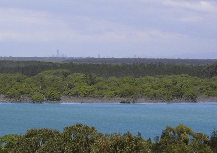
At the south end of the island you can
see the tall buildings on the Gold Coast off in
the distance.
|
|
|
|
|
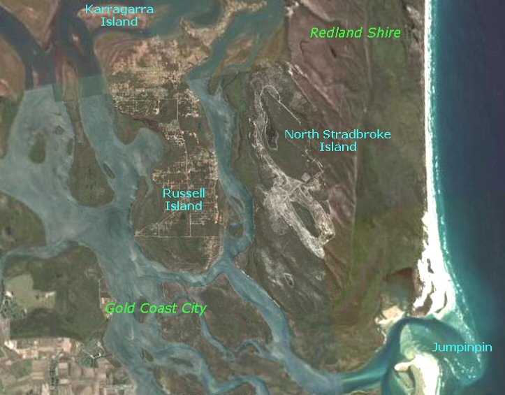
| AERIAL MAP: You can see the large
bushland areas and urban areas. All of the waterways around
Russell Island are navigable. Going through Jumpinpin
to open ocean can be dangerous for small craft. It is
best to stay well inside for camping and fishing unless
you are experienced with the local conditions. |
|
|
|
|
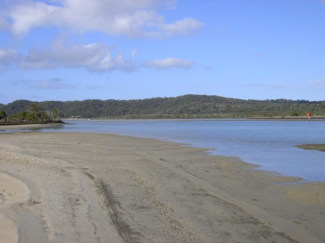
At the south end of
Russell Island is the best beach, where you can walk
out to at low tide.
|
|
|
|
|
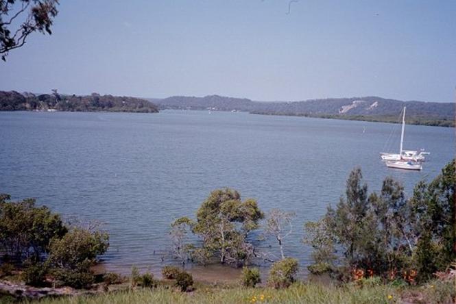
Looking
north along Canaipa Passage, on the left is the northeast
end of Russell Island and North Stradbroke Island is
on the right.
|
|
|
|
ACCESS
There is no bridge, therefore access to the
island is via water, by either the ferry service (waterbus)
for foot passengers, or on the barge for vehicles.
|
|
|
|
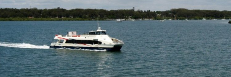
An
excellent, reliable, fast, ferry service
to Russell, Macleay, Lamb and Karragarra
Islands is provided by Bay Islands Transit
System (BITS). Ferries depart from the Weinam
Creek Marina, Banana Street, Redland Bay
approximately every half hour, running from
4 am till 12 pm and the service is operational
7 days a week 365 days a year.
The
waterbuses are modern diesel powered catamarans
that seat over a hundred passengers and
travel at over 20 knots per hour, making
the direct trip to Russell Island in 15
minutes.
The
Barge servicing the Bay Islands is operated
by Stradbroke Ferries and departs from Redland
bay approximately every hour on weekdays
and about every 2 hours on weekends and
public holidays.
|
| |
|
|
|
|
|
|
|
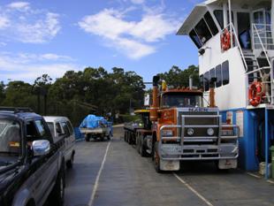
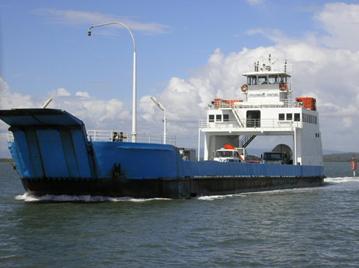
Above
Left: This is the vehicle barge which has a
large capacity, for example note the cement
truck at the back.
Above Right: The barge at Russell Island boat
ramp.
Below: Waterbus.
|
|
|
|
|
|
|
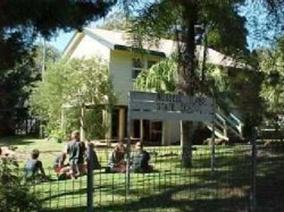
RECREATION
Water, Parks, Relaxation, Socialisation
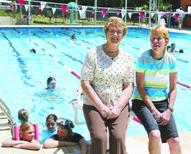
§ Public Swimming Pool: The six-lane 25 metre
pool complex is managed by the YMCA, and includes
changing rooms, a kiosk, and shaded children's
wading and play pools.
§ Fishing: The waters surrounding
the islands are abundant with fish life, and fishing
can be from the numerous places on shore around
the island such as from the main Jetty, the public
boat ramps, the parks such as Sandy Beach, and
areas such as Rocky Point, or fishing via boat
to offshore locations.
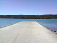
§ Boating: The island has numerous
places to launch a boat, the best being the main
boat ramp on the east coast launching directly
into the deep water of Canaipa Passage. The places
to travel to by boat are numerous and diverse.
These include the other smaller islands within
Moreton Bay, North Stradbroke and South Stradbroke
Islands and the places to stop off on these islands.
§ Sport: Jackson Oval located
on the western side of the Island at the end of
Jackson Road is just under 3 kms by road from
the main jetty. The oval is where sporting activities
such as little athletics and cricket are held.
§ Beach: Sandy Beach Lions
Park - a beautiful little spot located on the
southern end of the island, and has facilities
that include a barbeque, park benches and a toilet.
§ Bowls Club: Russell Island Bowls
Club not only has greens catering for the needs
of the bowler but also has a bar and restaurant,
a gaming lounge and runs a courtesy bus.
§
RSL: The RSL Club on Russell
Island has a courtesy bus, live entertainment,
and a social club.
|
|
|
|
|
|
|
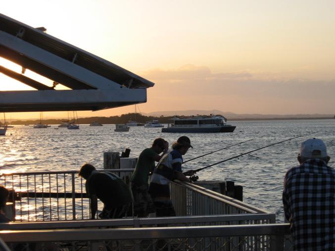
Fishing off the jetty
near where the water taxi berths as dusk arrives.
|
|
|
Waste
Water
The Redland Shire is planning to install a small sewerage
plant in the future (following a study into the best
options carried-out in May 2002), but in the meantime
septic tanks and trench systems have to be installed
during construction to treat household waste water.
Soil tests are carried out prior to building and building
approval to determine the length of trenches needed
and to consider the options available regarding waste
water treatment.
Police
Station
The first police station officially opened in June 2008
on Russell Island.
ROADS
& TRANSPORT
A Transport Plan was released for comment by the Redland
Shire in May 2002. A car costs about $95 return on the
barge ($65 for locals) and the waterbus costs $12 return
($10 if you buy in bulk). The Redland Shire has recently
approached the State Government for a large increase
in funding to improve the roads on Russell Island.
Roads
The Redland Shire Council is continuously upgrading
the roads on the island, which are a mixture of the
original roads tracks from years past, to graded dirt/sand
roads, gravel roads, bitumen sealed with some having
kerb and channelling, and in some areas there are concrete
roads. Some areas are also having bike paths built.
To get around the island you can drive your own vehicle;
take a local bus or taxi.
BRIDGE
John Burns the councillor for Russell Island has again
floated the idea of a bridge in the local press. There
is a local lobby group which is pro-bridge and very
active. At present the Queensland Government's position
is that it will not be built. However the ferries will
have trouble coping with population growth to a capacity
of 13,500 and car parks are already overflowing. The
locals at Redland Bay are not happy about the prospect
of huge high-rise car parks being planned to be constructed
on the foreshore.
A
bridge in the long term seems to be the only sensible
option to solve the car parking problems, vehicle access,
access for construction (material cartage), sewage and
power. We are expecting Local Government announcements
regarding bridge options in the next couple of years.
If a bridge is built, land prices may well escalate
to come into line with mainland prices, as developer
demand increases with easy access to cheap bay side
land.
New
Barge into the south end of Russell Island
There has been a lot of talk in the media over the last
few weeks about a new service. To the South end of the
island the distance could be as little as 1.5k instead
of 12km. Discussions with the Council, State Government
and ferry operators is progressing.
|
|
|
|
|
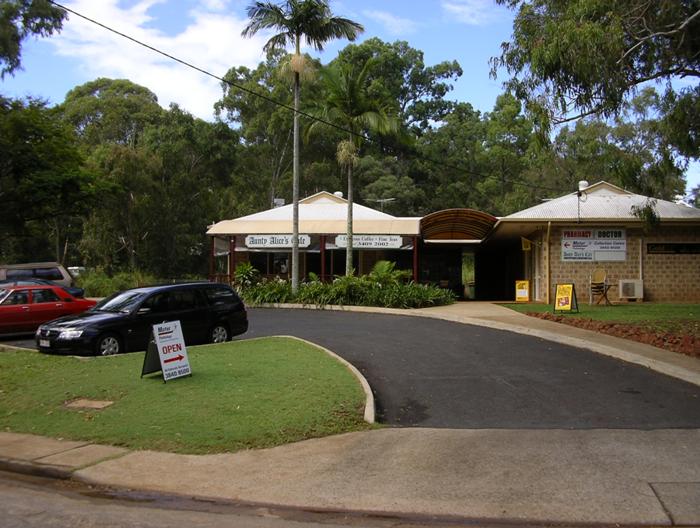
Shopping:
Near the main jetty there is a small group of shops
which includes a café.
|
|
|
|
|
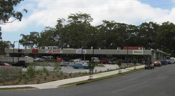
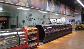
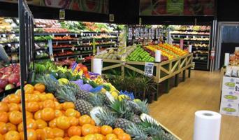
SUPER
IGA - Supermarket and shops
In High Street there is a 1250m2 supermarket complex,
with the recently opened IGA store, and specialty shops;
Butcher, Bakery, Hair Salon, Take Away, and Pharmacy.
Local residents shop locally most of the time.
|
|
|
|
|
|
EDUCATION
Located in the north of the island there is a
primary school, a couple of small shopping centres,
one of which has a large supermarket. Currently
high school students attend school on the mainland
making the journey via water taxi daily.
INDUSTRY
& EMPLOYMENT
The island has its own concrete batching plant.
Trades: There are numerous trades represented
on the island(s).
SERVICES
& UTILITIES
All blocks of land on the island have reticulated
water, electricity and telephone available to
them. Water was connected from North Stradbroke
Island in 1993. Phone and power comes across from
the mainland. Weekly garbage collection goes back
to the mainland also. Shire rates on a vacant
block of land are $1100 per year.
|
|
|
|
| In
1996 Redland Shire and the QLD State Government started
an inquiry into the land use on the Bay Islands. The Redland
Shire offered to buy back numerous blocks as they decided
that large areas originally designated for residential
would now be turned into conservation areas. From rough
calculations it appears that only about 50% of Russell
Island will be available for urban development. |
|
| Residential
land on Russell Island is not flood-prone like the Gold
Coast and Brisbane, which are both built on flood plains.
Russell Island is quite hilly and is 46m above sea level
at the highest point and you are generally not allowed
to build on low areas or valleys. The conservation areas
include some attractive wetlands with many native wild
flowers and even some freshwater lakes. |
|
|
Waste
Water
The Redland Shire is planning to install a small sewerage
plant in the future (following a study into the best
options carried-out in May 2002), but in the meantime
septic tanks and trench systems have to be installed
during construction to treat household waste water.
Soil tests are carried out prior to building and building
approval to determine the length of trenches needed
and to consider the options available regarding waste
water treatment.
Police
Station
The first police station officially opened in June 2008
on Russell Island.
ROADS
& TRANSPORT
A Transport Plan was released for comment by the Redland
Shire in May 2002. A car costs about $95 return on the
barge ($65 for locals) and the waterbus costs $12 return
($10 if you buy in bulk). The Redland Shire has recently
approached the State Government for a large increase
in funding to improve the roads on Russell Island.
Roads
The Redland Shire Council is continuously upgrading
the roads on the island, which are a mixture of the
original roads tracks from years past, to graded dirt/sand
roads, gravel roads, bitumen sealed with some having
kerb and channelling, and in some areas there are concrete
roads. Some areas are also having bike paths built.
To get around the island you can drive your own vehicle;
take a local bus or taxi.
BRIDGE
John Burns the councillor for Russell Island has again
floated the idea of a bridge in the local press. There
is a local lobby group which is pro-bridge and very
active. At present the Queensland Government's position
is that it will not be built. However the ferries will
have trouble coping with population growth to a capacity
of 13,500 and car parks are already overflowing. The
locals at Redland Bay are not happy about the prospect
of huge high-rise car parks being planned to be constructed
on the foreshore.
A
bridge in the long term seems to be the only sensible
option to solve the car parking problems, vehicle access,
access for construction (material cartage), sewage and
power. We are expecting Local Government announcements
regarding bridge options in the next couple of years.
If a bridge is built, land prices may well escalate
to come into line with mainland prices, as developer
demand increases with easy access to cheap bay side
land.
New
Barge into the south end of Russell Island
There has been a lot of talk in the media over the last
few weeks about a new service. To the South end of the
island the distance could be as little as 1.5k instead
of 12km. Discussions with the Council, State Government
and ferry operators is progressing.
|
| |
| RUSSELL
ISLAND DEMOGRAPHICS
|
|
|
Local
Government Authority
Redland Shire Council
Location
Approximately 50km to Brisbane, or the Gold Coast
Features
Island lifestyle off the coast of Cleveland
|
|
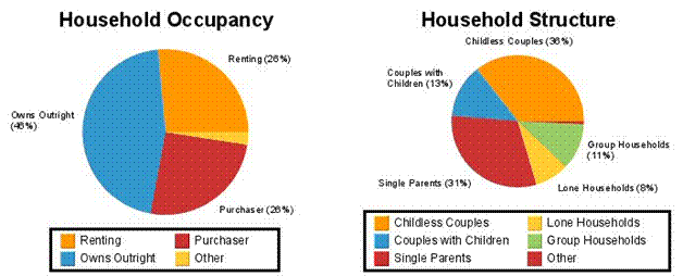
| Households
on Russell Island are primarily couples without children.
The population is 2154 according to the 2006 Censes. Redland
Shire claims this figure is wrong. The developer who built
the Supermarket believes the population is 4000 people
and this is supported by the postal deliverers. There
are nearly 100 new dwellings built each year. |
| |
|
|
| |
|
|
|
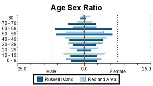
AGES
In
the 2006 Census (held on 8th August 2006), 50.6% were
males and 49.4% were females. Of the total population
in Russell Island 2.5% were Indigenous persons, compared
with 2.3% Indigenous persons in Australia.
Of
the population usually resident in Russell Island were
children aged between 0-14 years, and 45.5% were persons
aged 55 years and over. The median age of persons in
Russell Island was 52 years, compared with 37 years
for persons in Australia.
|
| |
|
|
| |
AGE GROUPS
|
% of
total persons in Region
|
|
0-4 years
|
4.1%
|
|
5-14 years
|
11.4%
|
|
15-24 years
|
6.8%
|
|
25-54 years
|
32.2%
|
|
55-64 years
|
25.2%
|
|
65 years and over
|
20.3%
|
|
| |
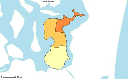
| POPULATION
DENSITY (2006 ABS) |
|
 |
|
|
| In the 2006 Census 15.5% of the population usually resident in Russell
Island were children aged between 0-14 years, and 45.5%
were persons aged 55 years and over. The median age of
persons in Russell Island was 52 years, compared with
37 years for persons in Australia. |
| |
|
|
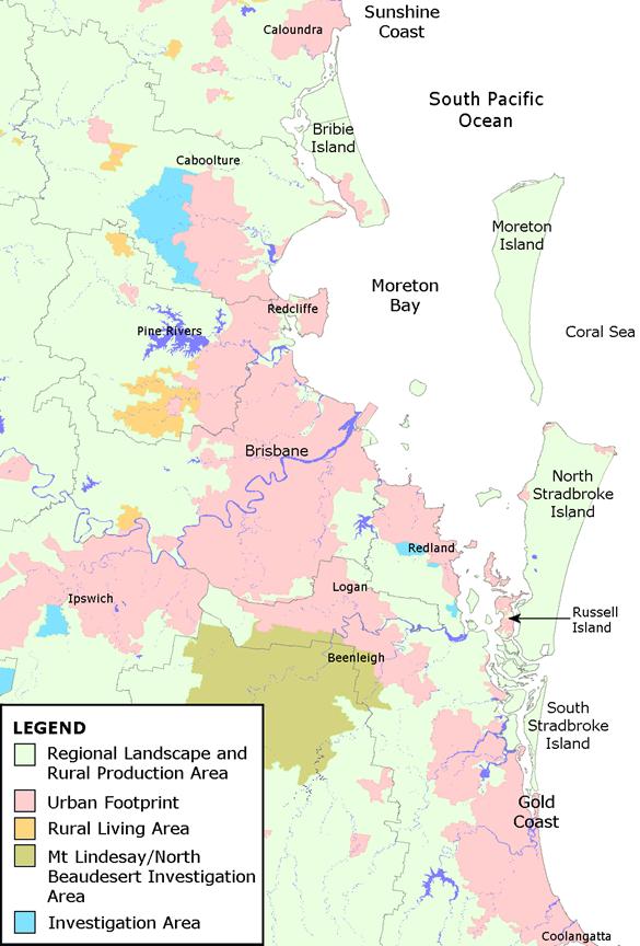
| Southeast
Queensland. Further south there is easy access to
the northern half of the Gold Coast via the Broadwater,
Nerang River and the canal system. On a good day you could
get from Surfers Paradise to the southern end of Russell
Island in just over 30 minutes by boat. |
| |
·
Redland
Shire Council
·
Internet
·
Locals
·
Personal
knowledge
·
REIQ
·
ABS
·
RPDATA
·
PDS
|
| |